

Close Menu
Terrain News
  • Environmental Science
  • Landforms & Habitats
  • Extreme Events
  • Watershed Restoration
  • Wildfire
What's Hot

A Fourth Grader’s Journey: Exploring Lake Champlain with Sea Grant Insights

Norfolk Southern Completes Elizabeth River Shoreline Restoration Project

Urgent Evacuation Advisory for Allenspark Wildfire Threat

Facebook X (Twitter) Instagram
Facebook X (Twitter) Instagram Pinterest
Terrain News
TerrainWorks
  • Environmental Science
  • Landforms & Habitats
  • Extreme Events
  • Watershed Restoration
  • Wildfire
Terrain News
You are at:Home»Wildfire»Enhanced Weather Stations in Hawaiʻi Improve Wildfire Risk Evaluation
Wildfire

Enhanced Weather Stations in Hawaiʻi Improve Wildfire Risk Evaluation

Terrain NewsBy Terrain NewsNovember 20, 2025021 Min Read
Share Facebook Twitter Pinterest LinkedIn Tumblr Email
Enhanced Weather Stations In Hawaiʻi Improve Wildfire Risk Evaluation
Share
Facebook Twitter LinkedIn Pinterest Email

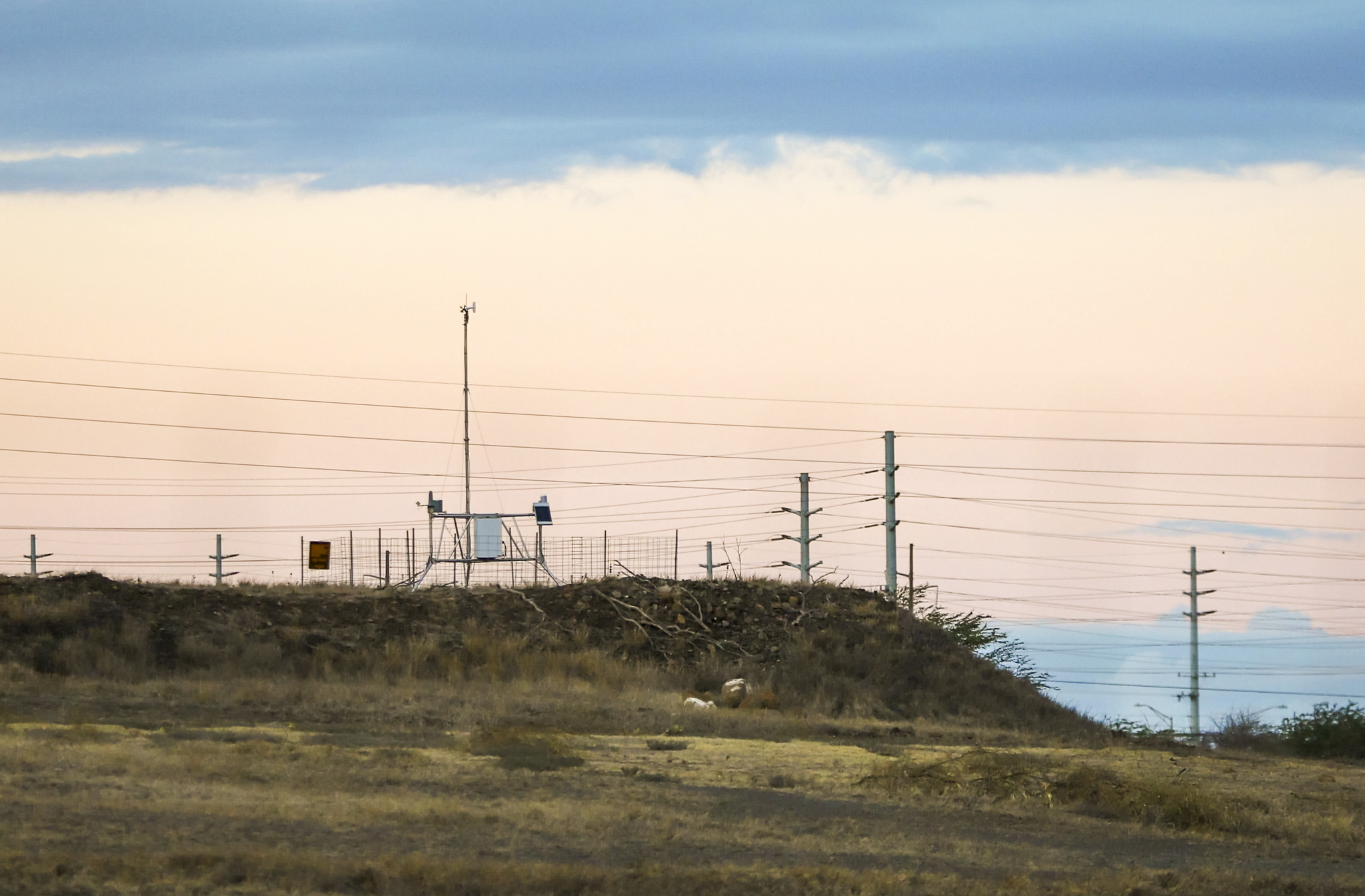
In response to the devastating August 2023 fires, Hawaii has installed 16 new weather stations across Maui County, part of a plan to nearly triple statewide weather monitoring. These solar-powered stations measure critical factors like temperature, humidity, and wind speed to enhance wildfire preparedness. Previously, there were no automatic weather stations in West Maui, limiting data during fire emergencies.

The state now has about 150 to 200 weather stations across Hawaii, with substantial additions since the fires. The new network aims to provide accurate, localized predictions and help officials assess fire risks, even in areas lacking active red flag warnings. Local fire management and federal agencies are collaborating on improving wildfire risk communication, aiming for a significant fire outlook by 2026. Enhanced data collection will aid in better resource management and community awareness, addressing urgent needs for improved wildfire response.

Source link

Enhanced Evaluation Hawaiʻi Improve Risk Stations Weather Wildfire
Share. Facebook Twitter Pinterest LinkedIn Tumblr Email
Previous ArticleFrom Fireflies to Floods: A Student Explores the Local Environment
Next Article Utah’s Watershed Initiative: Restoring 144K Acres in 2024-2025
leebenda
Terrain News
  • Website

Related Posts

Urgent Evacuation Advisory for Allenspark Wildfire Threat

October 6, 2026

Wildfire at Oak Mountain State Park Nears Full Containment

October 5, 2026

Alabama Forestry Commission Updates on Oak Mountain State Park Wildfire Recovery

October 2, 2026
Top Posts

Steamboat Secures $5 Million for River Revitalization

January 25, 202523 Views

Assessing Climate Change and Human Influence on Runoff in a South China Tropical Watershed

February 3, 202520 Views

Impact of Glacier Retreat on Land Use and Ecosystem Services in High Andes

February 3, 202520 Views
Stay In Touch
  • Facebook
  • YouTube
  • TikTok
  • WhatsApp
  • Twitter
  • Instagram
Most Popular

Steamboat Secures $5 Million for River Revitalization

January 25, 202523 Views

Assessing Climate Change and Human Influence on Runoff in a South China Tropical Watershed

February 3, 202520 Views

Impact of Glacier Retreat on Land Use and Ecosystem Services in High Andes

February 3, 202520 Views
Don't Miss

A Fourth Grader’s Journey: Exploring Lake Champlain with Sea Grant Insights

Norfolk Southern Completes Elizabeth River Shoreline Restoration Project

Urgent Evacuation Advisory for Allenspark Wildfire Threat

Popular This Week

Decoding Climate Disasters: Insights from Decades of Data on Fatalities

Revitalizing the Merrimack River: $228K Grant Boosts Restoration Efforts

A Fourth Grader’s Journey: Exploring Lake Champlain with Sea Grant Insights

© 2026 Terrain News. All Rights Reserved.
  • About Us
  • Privacy Policy
  • Terms and Conditions
  • Disclaimer

Type above and press Enter to search. Press Esc to cancel.