Close Menu
Terrain News
  • Environmental Science
  • Landforms & Habitats
  • Extreme Events
  • Watershed Restoration
  • Wildfire
What's Hot

Edgewood Fire Contained as I-280 Lanes Reopen in San Mateo County

Chesapeake Bay Update: Celebrating Clean Water Achievements and Funding Opportunities

Los Angeles City Council Prohibits Disaster Tours in Pacific Palisades Fire Area

Facebook X (Twitter) Instagram
Facebook X (Twitter) Instagram Pinterest
Terrain News
TerrainWorks
  • Environmental Science
  • Landforms & Habitats
  • Extreme Events
  • Watershed Restoration
  • Wildfire
Terrain News
You are at:Home»Wildfire»Wildfire Warning Issued as Strong Winds Approach North Gyeongsang and Gangwon
Wildfire

Wildfire Warning Issued as Strong Winds Approach North Gyeongsang and Gangwon

Terrain NewsBy Terrain NewsApril 7, 2025001 Min Read
Share Facebook Twitter Pinterest LinkedIn Tumblr Email
Wildfire Warning Issued As Strong Winds Approach North Gyeongsang And
Share
Facebook Twitter LinkedIn Pinterest Email

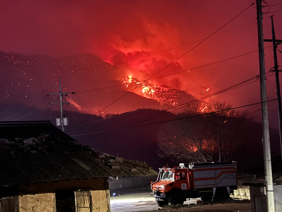
The South Korean government is enhancing wildfire preparedness as forecasts predict strong winds similar to those experienced during severe wildfires in North Gyeongsang last March. The Ministry of the Interior and Safety held an emergency meeting to assess readiness in regions like Yeongdong, Gangwon, and North Gyeongsang’s coast. Deputy head Lee Han-kyung warned that expected wind speeds could exceed 20 meters per second along the coast and 25 meters per second in mountainous areas, raising concerns for rapid fire spread. In response, the Korea Forest Service and National Fire Agency have mobilized firefighting resources and local governments are preparing evacuation plans, particularly for vulnerable populations. Lee emphasized the need for vigilance and adherence to wildfire safety guidelines.

Source link

Approach Gangwon Gyeongsang Issued North Strong Warning Wildfire Winds
Share. Facebook Twitter Pinterest LinkedIn Tumblr Email
Previous ArticleMapping Erosion and Land Degradation in Indonesia’s Middle Citarum Sub-Watershed Using GIS and AHP
Next Article Reviving the Eel River: A Path to Restoring California’s Third Largest Watershed
leebenda
Terrain News
  • Website

Related Posts

Edgewood Fire Contained as I-280 Lanes Reopen in San Mateo County

August 31, 2025

Los Angeles City Council Prohibits Disaster Tours in Pacific Palisades Fire Area

August 30, 2025

Elko County Wildfire Update: Progress in Containment Efforts

August 29, 2025
Top Posts

Harnessing Machine Learning to Enhance Extreme Weather Alerts

January 8, 202515 Views

Understanding Extreme Weather: The Link to the Climate Crisis

January 8, 202515 Views

Human Influence on Our Landscapes

January 8, 202514 Views
Stay In Touch
  • Facebook
  • YouTube
  • TikTok
  • WhatsApp
  • Twitter
  • Instagram
Most Popular

Harnessing Machine Learning to Enhance Extreme Weather Alerts

January 8, 202515 Views

Understanding Extreme Weather: The Link to the Climate Crisis

January 8, 202515 Views

Human Influence on Our Landscapes

January 8, 202514 Views
Don't Miss

Edgewood Fire Contained as I-280 Lanes Reopen in San Mateo County

Chesapeake Bay Update: Celebrating Clean Water Achievements and Funding Opportunities

Los Angeles City Council Prohibits Disaster Tours in Pacific Palisades Fire Area

Popular This Week

Edgewood Fire Contained as I-280 Lanes Reopen in San Mateo County

Chesapeake Bay Update: Celebrating Clean Water Achievements and Funding Opportunities

Los Angeles City Council Prohibits Disaster Tours in Pacific Palisades Fire Area

© 2025 Terrain News. All Rights Reserved.
  • About Us
  • Privacy Policy
  • Terms and Conditions
  • Disclaimer

Type above and press Enter to search. Press Esc to cancel.