Close Menu
Terrain News
  • Environmental Science
  • Landforms & Habitats
  • Extreme Events
  • Watershed Restoration
  • Wildfire
What's Hot

Creating a Swift Wildfire Response Standard

Ohio River Basin Restoration: A Collaborative Action Plan Unveiled

Evacuation Alerts Issued as Gilmore Trail Fire Expands Near Fairbanks

Facebook X (Twitter) Instagram
Facebook X (Twitter) Instagram Pinterest
Terrain News
TerrainWorks
  • Environmental Science
  • Landforms & Habitats
  • Extreme Events
  • Watershed Restoration
  • Wildfire
Terrain News
You are at:Home»Watershed & Environmental Science»App Tool Measures Pesticide Toxicity Levels
Watershed & Environmental Science

App Tool Measures Pesticide Toxicity Levels

Terrain NewsBy Terrain NewsFebruary 28, 2025001 Min Read
Share Facebook Twitter Pinterest LinkedIn Tumblr Email
App Tool Measures Pesticide Toxicity Levels
Share
Facebook Twitter LinkedIn Pinterest Email

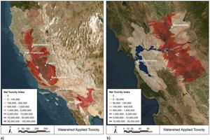
A study by Nicol Parker and Arturo A Keller from the University of California, Santa Barbara, published in PLOS Water, introduces the Environmental Release Tool (ERT), which evaluates the toxicity of pesticides in California’s agricultural watersheds. The ERT, based on US Geological Survey data, analyzes pesticide applications across 140 watersheds, revealing that a few pesticides and crops account for the majority of aquatic toxicity. By focusing on just two pesticides and sixteen sites, mitigation efforts could reduce around 90% of toxicity to aquatic life. The findings indicate that targeting a small number of high-toxicity watersheds could effectively lower overall pesticide environmental impact. However, the tool does not assess risks to human health or broader ecosystem effects. The study emphasizes the potential for selecting less toxic alternatives in agriculture to enhance toxicity reductions.

For access to the full article, visit: PLOS Water

Source link

App Levels Measures Pesticide Tool Toxicity
Share. Facebook Twitter Pinterest LinkedIn Tumblr Email
Previous ArticleRevitalizing Nanticoke Creek: A Watershed Restoration Project
Next Article Race to Protect the Most Vulnerable from Extreme Weather Impacts
leebenda
Terrain News
  • Website

Related Posts

Cal Fire Calls for Proactive Measures as California Wildfires Intensify

June 19, 2025

Chesapeake Bay Report Card Highlights Decline in Health for 2024

June 12, 2025

Explore Watershed Science with Union County and AmeriCorps

June 5, 2025
Top Posts

Harnessing Machine Learning to Enhance Extreme Weather Alerts

January 8, 202515 Views

Understanding Extreme Weather: The Link to the Climate Crisis

January 8, 202515 Views

Human Influence on Our Landscapes

January 8, 202514 Views
Stay In Touch
  • Facebook
  • YouTube
  • TikTok
  • WhatsApp
  • Twitter
  • Instagram
Most Popular

Harnessing Machine Learning to Enhance Extreme Weather Alerts

January 8, 202515 Views

Understanding Extreme Weather: The Link to the Climate Crisis

January 8, 202515 Views

Human Influence on Our Landscapes

January 8, 202514 Views
Don't Miss

Creating a Swift Wildfire Response Standard

Ohio River Basin Restoration: A Collaborative Action Plan Unveiled

Evacuation Alerts Issued as Gilmore Trail Fire Expands Near Fairbanks

Popular This Week

Rethinking Rifle Creek: Innovative Solutions for Restoration

Creating a Swift Wildfire Response Standard

Ohio River Basin Restoration: A Collaborative Action Plan Unveiled

© 2025 Terrain News. All Rights Reserved.
  • About Us
  • Privacy Policy
  • Terms and Conditions
  • Disclaimer

Type above and press Enter to search. Press Esc to cancel.