Close Menu
Terrain News
  • Environmental Science
  • Landforms & Habitats
  • Extreme Events
  • Watershed Restoration
  • Wildfire
What's Hot

Evacuation Alerts Issued as Gilmore Trail Fire Expands Near Fairbanks

Cranberry Creek Dam Removal: Enhancing Brook Trout Habitat and Revitalizing the Mountains-to-Sea Trail

Cal Fire Calls for Proactive Measures as California Wildfires Intensify

Facebook X (Twitter) Instagram
Facebook X (Twitter) Instagram Pinterest
Terrain News
TerrainWorks
  • Environmental Science
  • Landforms & Habitats
  • Extreme Events
  • Watershed Restoration
  • Wildfire
Terrain News
You are at:Home»Landforms, Processes & Habitats»Evaluating Human Settlement Patterns in Arid Regions Using GIS Analysis
Landforms, Processes & Habitats

Evaluating Human Settlement Patterns in Arid Regions Using GIS Analysis

Terrain NewsBy Terrain NewsFebruary 9, 2025002 Mins Read
Share Facebook Twitter Pinterest LinkedIn Tumblr Email
Evaluating Human Settlement Patterns In Arid Regions Using Gis Analysis
Share
Facebook Twitter LinkedIn Pinterest Email

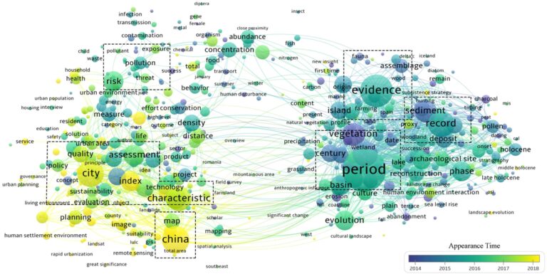
The article examines the Human Settlement Environment (HSE) in arid areas, particularly focusing on Gansu Province in Northwestern China. It highlights how the natural and social environments significantly influence residential satisfaction and sustainable development, especially in the context of climate change and increasing urbanization. The study employs Geographic Information Systems (GIS) and Analytical Hierarchy Process (AHP) methods to evaluate the suitability of HSE by considering both natural and cultural factors.

Key findings highlight significant disparities in the suitability of the HSE across different regions. Areas with high suitability are generally located near urban centers like Lanzhou, while lesser-suitable zones are found in remote, harsh terrains. The study classifies the HSE suitability into five categories from highly suitable to unsuitable, revealing a concentration of higher suitability in central urban areas.

The research concludes that resilient planning and infrastructure improvements are necessary in arid regions to counter extreme climate impacts and resource shortages. It emphasizes the need for comprehensive data integration, combining remote sensing and field surveys to better understand and improve the HSE conditions in vulnerable areas. Furthermore, while the study presents a robust evaluation model, the authors identify limitations due to data availability and suggest that future research could enhance the accuracy and completeness of HSE assessments.

Source link

Analysis Arid Evaluating GIS Human Patterns Regions Settlement
Share. Facebook Twitter Pinterest LinkedIn Tumblr Email
Previous ArticleEvaluating Meteorological and Socioeconomic Drought Impacts in Northern Ethiopia’s Tekeze Watershed
Next Article Impact of Leaf Characteristics, Landscape Features, and Nutrient Inputs on Stream Water Quality in the Upper Midwest
leebenda
Terrain News
  • Website

Related Posts

Understanding Climate Change: Kid-Friendly Facts

June 15, 2025

The Environmental Impact of War and Conflict

May 31, 2025

Transformations of Earth’s Land Surface Due to Human Impact

May 22, 2025
Top Posts

Harnessing Machine Learning to Enhance Extreme Weather Alerts

January 8, 202515 Views

Understanding Extreme Weather: The Link to the Climate Crisis

January 8, 202515 Views

Human Influence on Our Landscapes

January 8, 202514 Views
Stay In Touch
  • Facebook
  • YouTube
  • TikTok
  • WhatsApp
  • Twitter
  • Instagram
Most Popular

Harnessing Machine Learning to Enhance Extreme Weather Alerts

January 8, 202515 Views

Understanding Extreme Weather: The Link to the Climate Crisis

January 8, 202515 Views

Human Influence on Our Landscapes

January 8, 202514 Views
Don't Miss

Evacuation Alerts Issued as Gilmore Trail Fire Expands Near Fairbanks

Cranberry Creek Dam Removal: Enhancing Brook Trout Habitat and Revitalizing the Mountains-to-Sea Trail

Cal Fire Calls for Proactive Measures as California Wildfires Intensify

Popular This Week

Rethinking Rifle Creek: Innovative Solutions for Restoration

Evacuation Alerts Issued as Gilmore Trail Fire Expands Near Fairbanks

Cranberry Creek Dam Removal: Enhancing Brook Trout Habitat and Revitalizing the Mountains-to-Sea Trail

© 2025 Terrain News. All Rights Reserved.
  • About Us
  • Privacy Policy
  • Terms and Conditions
  • Disclaimer

Type above and press Enter to search. Press Esc to cancel.